By BarathVector Editorial — 2026-08-22
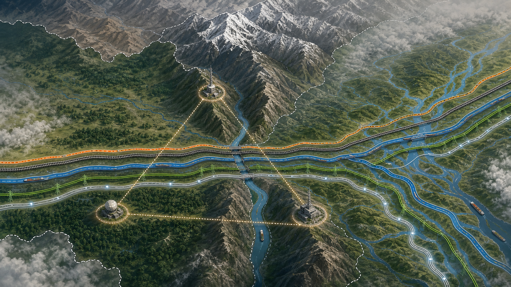
India is placing a triangular security grid around the Siliguri Corridor, with military garrisons at Chopra in West Bengal, Kishanganj in Bihar and Dhubri in Assam.
The logic is sound. The corridor is the principal overland connection between the rest of India and eight northeastern states. It sits near Nepal, Bhutan and Bangladesh, with the India-China-Bhutan tri-junction farther north. An adversary does not have to occupy the entire region to cause disruption; roads, railway lines, fuel movement, communications and public confidence are concentrated in a constrained space.
Home Minister Amit Shah's 21 August announcement and the security review at Sukna a day later therefore deserve more than ceremonial notice. The review brought together the Border Security Force, Sashastra Seema Bal, intelligence agencies, West Bengal Police and the state administration. That mix reveals the real problem: Siliguri is not protected by one force against one threat.
The three garrisons can improve presence, surveillance and response time. Durable security, however, requires a second move. India must reduce the consequences of any single failure by creating redundancy in command, transport, energy and data links. Reinforcement protects the chokepoint. Redundancy makes it less chokable.
What the triangle can do
Chopra sits on the western side of the corridor, near the routes entering North Bengal from Bihar. Kishanganj adds depth on the Bihar approach. Dhubri lies east of the corridor in western Assam, near the Brahmaputra and the Bangladesh border. Together they can support dispersed logistics, rapid deployment and intelligence coverage on both sides of the narrowest ground.
That geometry is useful against infiltration, sabotage and a local security breakdown. It also makes it harder for an attacker to treat Siliguri as a single isolated objective. But public statements have not described the grid's command arrangements, force levels, mobilisation standards or how the three nodes will communicate during a disruption. Operational secrecy is legitimate; institutional ambiguity is not.
The August announcement should also not be confused with the "quadrangular security grid" Shah discussed in July. The Home Ministry's July release used that phrase for a broader smart-border programme in West Bengal, alongside radio-based fence-breach detection, infrared alarms and gate-management systems. The triangular grid refers to three garrison locations around Siliguri. The public record does not yet explain how the two architectures fit together.
That distinction matters. Sensors along the Bangladesh border, SSB patrols on the open Nepal and Bhutan borders, Army formations, air defence, rail protection and state policing answer different chains of command. A map with several strong points is not yet a grid. It becomes one when information and authority move between them fast enough to act.
The military case is real
India's concern is not a fantasy produced by a narrow map. During the 2017 Doklam confrontation, China attempted road construction in territory claimed by Bhutan near the tri-junction. India's official statement at the time said a unilateral change to the status quo would have serious security implications for India.
The risk is broader than a conventional armoured thrust. A crisis could combine cyber interference, railway sabotage, disinformation, drone reconnaissance, border incidents and pressure on civilian movement. Floods or landslides could cause some of the same logistical effects without an enemy firing a shot. A security design built only for invasion would therefore protect against the most dramatic scenario and remain brittle against more probable ones.
The strongest case for concentrating forces is deterrence. Alternative corridors through Bangladesh or Myanmar depend on friendly governments, working infrastructure and political consent. They cannot replace sovereign Indian territory in a crisis. A visible, well-supported military posture at Siliguri is consequently indispensable.
But indispensability is not sufficiency.
Connectivity is part of deterrence
India has several ways to reduce the burden on Siliguri without pretending the corridor can be bypassed completely.
First, it can add parallel capacity within Indian territory. Parliament has already heard calls to revive the 50.8-kilometre Jalalgarh-Kishanganj rail project after the 2017 floods severed northeastern connectivity. In March 2026, another parliamentary intervention sought rail doubling through Bagdogra and Naxalbari, commercial use of a military siding and a chord line to reduce reversals and vulnerability near the borders. These are not glamorous projects. That is precisely why they are useful: resilience is built from routes that remain available when the preferred one is congested or damaged.
Second, India can shift suitable cargo to rivers. An Inland Waterways Authority of India study estimated that about 8 million tonnes a year of the cargo examined had potential to move to inland waterways, with roughly 3 million tonnes destined for the Northeast more readily divertible. Waterways will not move an army at road speed, but every tonne of routine bulk cargo taken off a constrained land corridor creates spare capacity.
Third, India can preserve negotiated access through Bangladesh. An Asian Development Bank-backed corridor study found that routes through Bangladesh and access to Chattogram could sharply reduce transport distance and cost for parts of the Northeast. The Akhaura-Agartala rail link, inland-water transit routes and access to Chattogram and Mongla ports are economic assets in peacetime and potential logistical alternatives during disruption.
They are not guaranteed wartime corridors. Relations with Dhaka can change; Myanmar's instability limits the Kaladan route; river depth and terminals constrain waterways. Redundancy means several imperfect options, not one miraculous replacement.
Do not turn a living region into a bunker
The Siliguri region is also a trading, farming, tourism and ecological space. Treating every border community as a security variable can damage local cooperation—the very human intelligence and legitimacy that border forces need.
A recent Indian Council of World Affairs paper argues that the corridor's habitual description as a vulnerable "Chicken's Neck" obscures its communities, tea economy, wildlife routes and potential as a South Asian junction. That is a useful correction, even if it should not erase military geography. Security and openness are not opposites when infrastructure is designed properly.
The test for the new grid is therefore practical. Can BSF, SSB, the Army, intelligence agencies, rail authorities, telecom operators and state governments share a common operating picture? Are there rehearsed fallbacks when a rail section, bridge, data cable or fuel depot fails? Can civilian traffic be rerouted without producing panic? Do local administrations know who commands the response before a crisis begins?
New Delhi should establish a permanent eastern-corridor fusion mechanism and run regular civil-military resilience exercises. It should also publish a non-sensitive annual readiness report covering infrastructure completion, alternate-route capacity, disaster exercises and agency coordination. Secrecy can protect tactics; it should not conceal whether basic resilience work exists.
Three garrisons make the Siliguri Corridor harder to threaten. Parallel rail, road, river, energy and data paths make a threat less rewarding. India needs both. A fortress still has a single gate. A resilient country makes sure no gate is singular.
Public statements do not disclose the triangular grid's force levels or command structure. This article assesses the announced geography and the open-source requirements of corridor resilience.